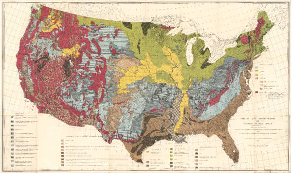
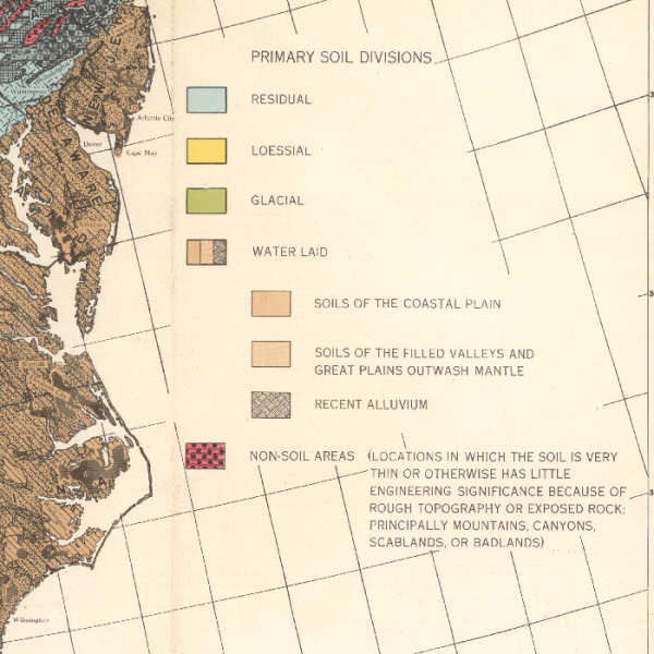
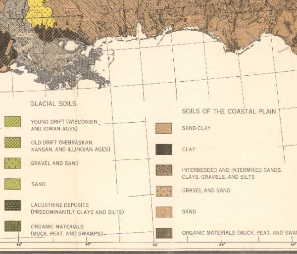
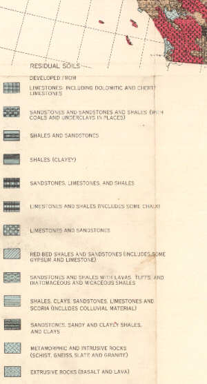
Belcher, D.J., Gregg, L.E., Woods, K.B., and Jenkins, D.S., 1946, Origin and distribution of United States soils: Washington, U.S. Dept. of Commerce. Civil Aeronautics Administration. 30" x 50" color map; Scale 1:4,000,000. Map shows the genetic (landform) basis of soils of the United States.
Linked above is a complete 6 MB PDF. Additional parts: Legend 1 Legend 2 Legend 3
Ray Kreig has the original .jpg 220 MB scan file of the whole map and also the 220 MB PDF.
This map was included in the back pocket of:
Jenkins, D.S., Belcher, D.J., Gregg, L.E., and Woods., K.B., 1946, The origin, distribution, and airphoto identification of United States soils. With special reference to airport and highway engineering: Washington, U.S. Dept. of Commerce, Civil Aeronautics Administration, Technical Development Report No. 52, 4 plates, l., 202 p.
It was separately reprinted one or more times prior to 1970 by coauthor Prof. D.J. Belcher at the Center for Aerial Photographic Studies, Cornell University School of Civil Engineering where it was used in classes.